About 45 miles6,512 feet · Cuyamaca
Up Cuyamaca Peak for a view to the sea and the desert
A paved fire road climbs to the second-highest summit in San Diego County, through a forest still recovering from the 2003 Cedar Fire, to a view that reaches both ways.
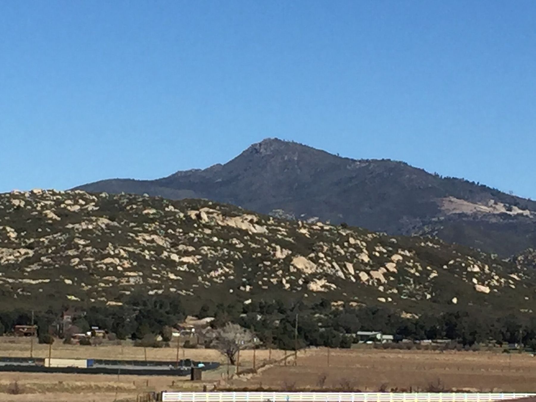
Cuyamaca Peak is the high point of Cuyamaca Rancho State Park and, at 6,512 feet, the second-highest summit in San Diego County, only a little lower than Hot Springs Mountain to the north. It is not a wild-looking peak. A paved fire road runs to the top, communication towers stand on the summit, and you share the way with other walkers and the occasional service truck. What makes the climb worth it is the view at the end, and the forest you walk through to get there.
A mountain that burned and is coming back
In October 2003 the Cedar Fire swept east from the inland foothills and burned through most of Cuyamaca Rancho State Park in a matter of days. It was one of the largest wildfires in California's recorded history at the time; across the county it destroyed thousands of homes and killed fifteen people. On Cuyamaca, it took out most of the old conifer forest that had covered the upper slopes.
The recovery is visible on every mile of the walk. Silver snags of dead pines still stand on the ridges. Between them, black oaks and canyon live oaks have resprouted from their roots and are thick and green again. Dense chaparral has filled much of the ground where the pines once stood, and in places young conifers planted after the fire are pushing up through the brush. It is a slow change, measured in decades, and the mountain looks different from one visit to the next.
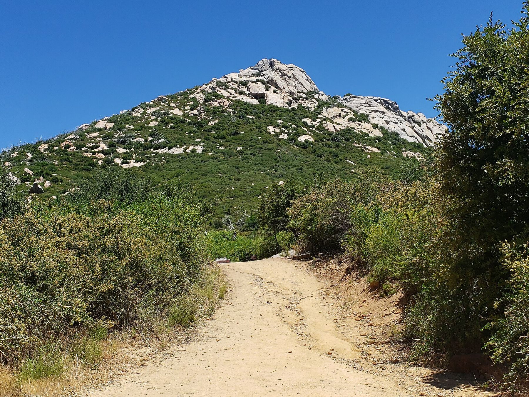
Fire remains part of life here. Red flag days, closures after storms and burn scars from more recent fires all shape when you can go. Check the park's current conditions before you set out.
The fire road from Paso Picacho
The usual route starts at Paso Picacho, the day-use area and campground on Highway 79 in the middle of the park. From there the Lookout Fire Road climbs steadily on old pavement to the summit. It is roughly 3 miles each way, with well over 1,500 feet of climbing, and it rarely eases off. The surface is easy to follow, which makes it a good first big climb, but the gradient is relentless, and the descent is hard on knees.
- Start early. Much of the road is exposed, and the slopes hold heat on summer afternoons.
- Pack extra water for the climb. There is none on the way.
- Expect cold wind on top in every season, and snow or ice in winter.
- Parking at Paso Picacho fills on weekends, and a day-use fee applies; check current rates and rules before you go.
Some walkers make a loop by coming down on the trails that run off the west side of the mountain toward the Azalea Glen area, or by linking to the trail network that spreads across the park. These routes are rougher and less obvious than the fire road. Take a good map and know where you are heading before you leave the pavement.
Across the highway from Paso Picacho, the granite dome of Stonewall Peak offers a shorter climb that starts from the same car park; Stonewall Peak at first light covers it.
The view across two counties of country
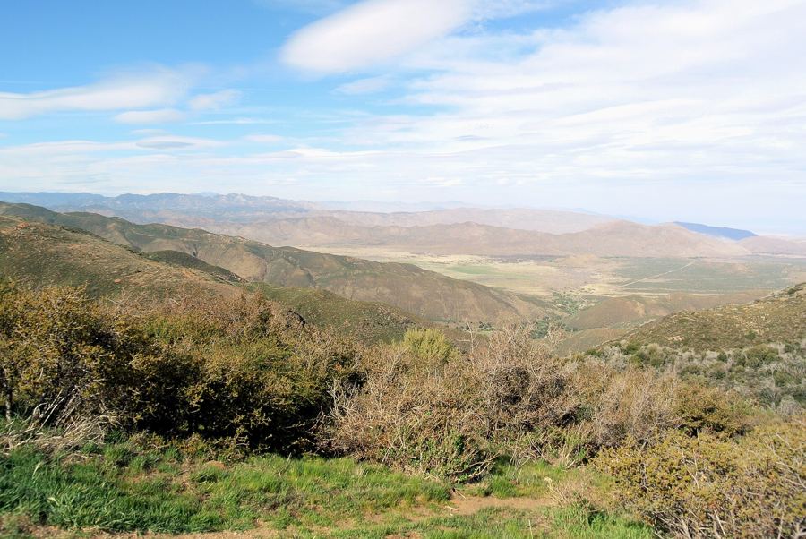
The summit is cluttered with towers and fencing, so walk around the edges to find the open views. On a clear winter day, the panorama is one of the widest in the county. To the west, ridges fall away toward the coastal plain, and on the best days the ocean shows as a bright line, with the islands off the coast visible beyond it in exceptional air. To the north lie Palomar Mountain and Volcan Mountain above Julian. To the east the land drops toward the Anza-Borrego desert, its pale basins and dark ranges laid out to the horizon.
 About 55 miles · Around 6,000 feetThe Desert View trail along the escarpment
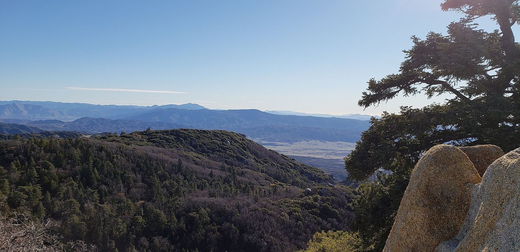
Haze often spoils the coastal view after midday, and in late spring the marine layer can cover everything west of the mountains. Mornings after a winter storm, when the wind has scrubbed the air, are when the view is longest. Those are also the coldest mornings, so dress for both.
Mornings after a winter storm, when the wind has scrubbed the air, are when the view is longest.
From the top you can also trace the line of the Laguna Mountains running southeast, with the escarpment that drops to the desert along their eastern edge. The walk along that edge at Mount Laguna is told in the Desert View trail along the escarpment.
Kumeyaay land and a ranch-house headquarters
Long before it was a park, Cuyamaca was Kumeyaay country. The Kumeyaay lived in these mountains in the warmer months, gathering acorns from the oaks, harvesting seeds and hunting, and moved to lower ground in winter. Bedrock mortars, the round grinding holes worn into granite, can still be found in parts of the park. The name Cuyamaca is usually traced to a Kumeyaay phrase connected with rain. The Kumeyaay remain here today, and their history is part of what the park protects.
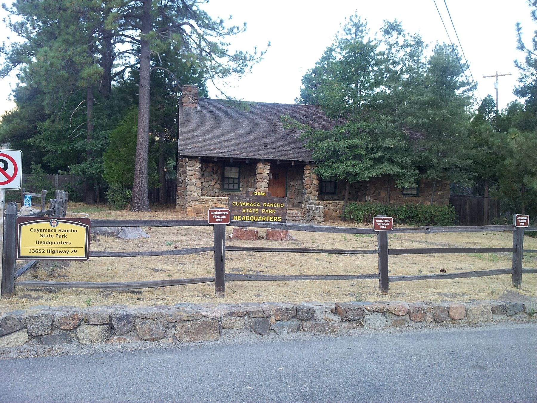
In the 1800s the land became a Mexican rancho, then a ranch and gold-mining district. The stone house on Highway 79 that serves as park headquarters was built in the 1920s as a family ranch home, a few years before the land became a state park in the 1930s. It houses a small museum on the park's people and history, though its opening days vary, so check before you go.
Choosing your day on the mountain
Autumn through spring is the season for this climb. Summer days are usually hot by late morning and often hazy, and afternoon thunderstorms can build over the high ground. In winter, snow can fall at any time from December to March, and the park and the state may close roads or require chains on Highway 79. After heavy storms, sections of trail may be closed to protect them from damage.
Weekday mornings are the quietest time on the fire road. On weekends, especially after a winter storm, the Paso Picacho car park can be full by mid-morning, and the road becomes a steady procession of walkers, runners and families heading for the snow. If you arrive to a full car park, do not squeeze onto the highway shoulder; the park's other trailheads along Highway 79 give access to different parts of the same mountains, and a quieter walk may suit the day better.
The climb also rewards a second look in different light. In the late afternoon of a clear autumn day, the low sun picks out every ridge to the west and turns the burned snags silver, while the desert to the east slips into shadow. If you stay for that light, carry a headlamp for the walk down, and remember that the park's closing time applies to the car park too.
Whatever the season, the essentials are the same: an early start, plenty of water, a windproof layer for the summit and a careful look at the forecast and park notices before you drive up. On the way home, Julian is a short drive north, and its gold-rush history is told in Julian's gold-rush past, block by block.