About 40 milesAround 5,000 feet · Palomar Mountain
Doane Pond and the conifer forest on Palomar
A high state park of cedar, fir and black oak, with a meadow pond in Doane Valley and a fire lookout on Boucher Hill. Cold mornings, busy weekends.
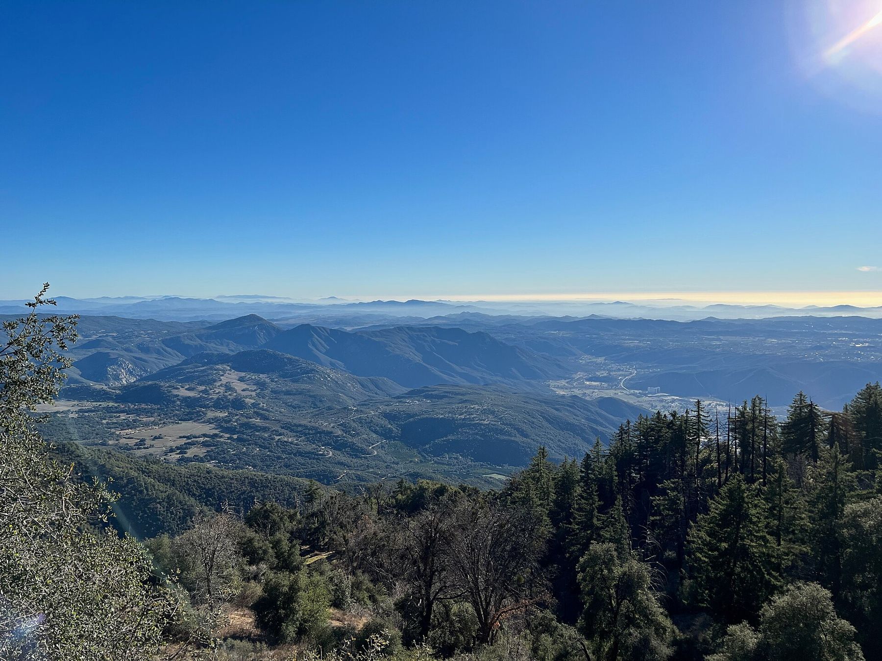
Palomar Mountain State Park covers the western end of the mountain, a short drive past the crossroads where the two grades from Highway 76 meet. It feels further north than it is. Incense cedar, white fir and tall pines grow beside black oaks, ferns fill the damp hollows, and in the early hours the air smells of resin and cold earth.
The park is small enough to see in a day but has enough trails to fill a weekend. Most visitors come for two places: Doane Pond in its open meadow, and the fire lookout on Boucher Hill at the park's high western edge.
A meadow pond in the middle of the woods
Doane Valley is a long, open meadow ringed by forest, and Doane Pond sits at its lower end. It is a modest body of water, but on a still morning it reflects the dark wall of conifers above it, and deer often graze along the edge of the grass before the first cars arrive.
Several trails start near the pond. A short nature loop wanders along the creek under the trees, and longer paths follow the valley downstream or climb back up through the forest toward the ridge. None is difficult, but the ground is uneven, roots cross the paths and the shaded sections stay muddy long after rain.
The pond is stocked with fish in some seasons and is popular with families who fish from the bank. A California fishing licence is required, and the park sets its own rules on limits and seasons, so check them before you cast.
Boucher Hill and the view to the sea
The high point of the park is Boucher Hill, which carries a fire lookout tower. A paved road loops up to it, and a trail climbs from the valley for those who prefer to walk. The lookout has been staffed by volunteers during fire season, and when it is open visitors are sometimes allowed up the stairs; whether it is open on any given day depends on the season and on who is on duty.
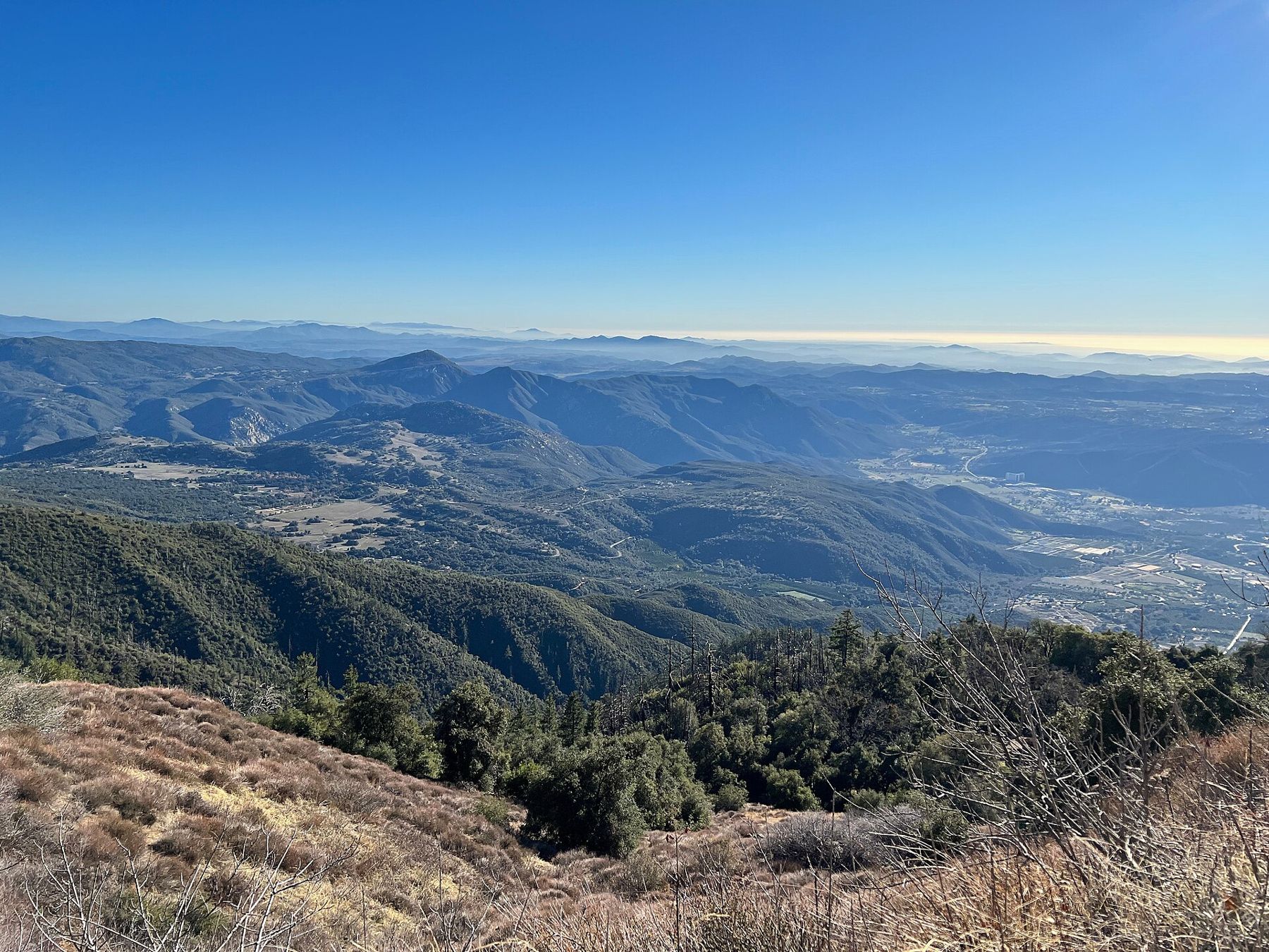
Even from the ground near the tower, the view is wide. To the west and south the land falls away in ridge after ridge of chaparral and oak to the inland valleys, and on clear days a pale line on the horizon marks the ocean. In late spring the marine layer often fills those valleys completely, and the hill stands above a white sea of cloud.
Cedar, fir and black oak
The forest is the reason to come. Palomar is high enough, and catches enough winter rain and snow, to support trees more typical of the Sierra Nevada than of Southern California. Incense cedars have shaggy, reddish bark and flat sprays of scale-like leaves. White firs carry short, soft needles and grow in tight, dark stands on the cooler slopes. Big pines, among them Coulter pines with their heavy, clawed cones, mix in on the drier ground.
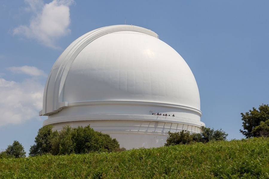 About 40 miles · Around 5,600 feetThe white dome on Palomar Mountain
California black oaks give the park its autumn colour. Their leaves turn yellow and bronze in late October and November, and the meadow grass goes gold at the same time. This is the season when the park is at its best and the air is clear, and it overlaps with apple season around Julian to the south; the story of apple season in the hills covers that drive.
The mountain has long been home to the Luiseño people, whose villages and seasonal camps used the oaks for acorns and the springs for water. Some place names and archaeological sites on and around the mountain reflect that history. Leave anything you find exactly where it is.
Cold mornings, full car parks
Palomar is cold for much of the year. Frost is common on autumn and spring mornings, and in winter the park can hold snow for days. When snow falls, people drive up from the coast in large numbers, the roads clog, and chains may be required on the grades. If you want snow without the crowds, go on a weekday and check road conditions first.
Weekends in good weather are busy in every season. The car parks near Doane Pond and the main picnic areas fill by late morning, and the campground is often full well in advance. Arriving early solves most of this, and it has the bonus of the best light: the first sun on the meadow, mist on the water and deer still out in the open.
- Expect to pay a day-use fee at the entrance; amounts change, so check before you go.
- Hours, closures and campground arrangements vary by season and after storms or fire.
- Dogs are generally limited to roads, car parks and campgrounds, not trails, as in most state parks.
Pairing the park with the dome
The observatory sits a few miles away along the same ridge, and many visitors combine the two. A natural order is the park in the cold early hours, when the light is soft and the pond is quiet, then a drive across to the observatory dome and the forest above it once it opens. If you have energy left, the Observatory Trail is a pleasant climb between the two in shade.
Coming down, take the East Grade if fog has rolled in, or if you would like the long view over Lake Henshaw and the valley toward the mountains around Julian. Whichever way you go, carry water and a warm layer, keep fuel in the tank, and check the park's current conditions before you leave home.